
3. Weather & Orography
Albenga Airport is located in a complex orographic area close to the coastline. Studies on the local winds and orography have shown that their interaction is the primary cause of the formation of wind shear.
The following climatological profiles highlight the distribution of the surface wind in two characteristic moments of the day:
At 06.00 local time, the prevailing situation is of wind calm and only occasionally some low intensity breeze,
At 15:00 local time, the wind presence is strong influenced by the visible effects of convective motions generated by the heating of the Earth’s surface. The wind intensity is even more robust during the winter period.
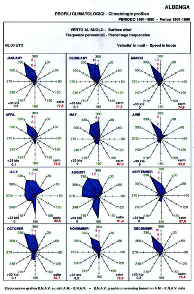
LIMG – Climatological Profile 06.00 local time
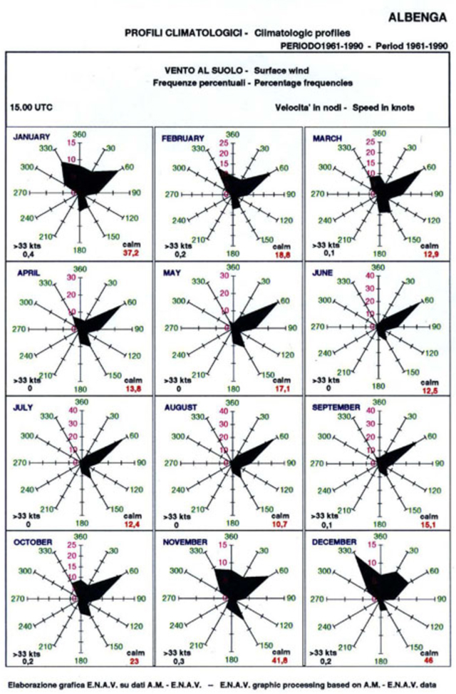
LIMG – Climatological Profile 15.00 local time
The previous analysis shows that at the 15.00 local time:
– In the period November – February, the prevailing wind direction is from northerly sectors (330° through 060°). Due to the local orography, the steady wind is usually associated to gusts and turbulence very close to the ground. These conditions could lead to the presence of wind shear.
– In the period March – October, the prevailing wind direction is from North-East. The wind intensity is very high and sometime can reach even 30 KTS leading to the developing of the wind shear phenomena. The intensity from other directions is usually lower than 10 KTS and does not affect the flying activities.
All the above lead to the following statement on the Albenga AIP:
“Aerodrome rarely affected by terrain-induced wind-shear phenomena, mostly originated by northern winds producing turbulence and vortices, which are highly variable both in space and time, along the approach path.”
Aeroporto Internazionale di Villanova d’Albenga “C. Panero” – Sito ufficiale
International Airport of Villanova d’Albenga “C. Panero” – Official site
Tutti i diritti riservati